SmartData Software
Drone data, inspection AI, 2D maps, 3D models, reporting, BYO hosting, and private deployment options for asset teams.
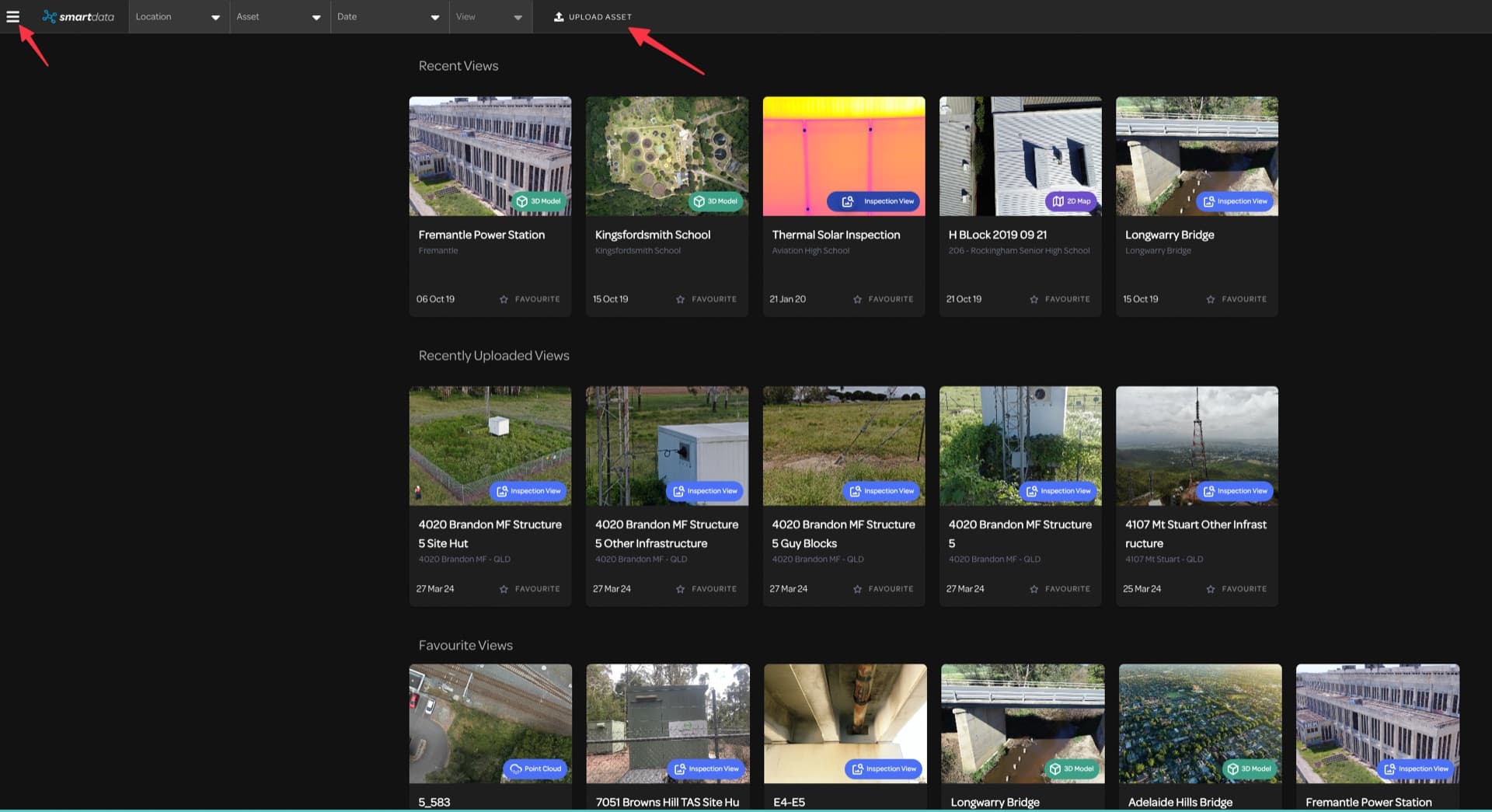
Our Software Suite
Purpose-built tools for asset management, drone evidence review, data visualisation, and private deployment.
2D Mapping
Accurate orthomosaic land mapping with high-resolution imagery. View and explore vast areas with resolution down to 3cm per pixel.
3D Modelling
Dynamic modelling for holistic visualisation. Create interactive, photorealistic 3D models from hundreds of high-resolution images.
Inspection Viewer
Interactive annotation for clear communication. Examine vertical assets in detail with high-resolution images and thermal overlays.
BYO and Private Hosting
Host viewer-ready drone datasets in SmartData, or plan a private cloud or self-hosted deployment for governed asset evidence.
New SmartData Workflows
Explore new SmartData workflows for DJI L3, Elios data, photogrammetry, Gaussian Splatting, powerline analytics, and forestry intelligence.
New SmartData Workflows
Upcoming and active workflows that turn SmartData from a hosted viewer into a processing and analytics platform.
DJI L3 Processing
Built for LiDAR programs where DJI L3 raw missions need to become map-aligned, browser-ready evidence without a manual DJI Terra handoff.
Early access
Elios Data Processing
A marketing path for confined-space inspection teams that need Elios data to become reviewable evidence, not just a folder of exported files.
Operational workflow
Photogrammetry Engine
The roadmap bridge from today's BYO hosted-view packages to a future capture-to-processing-to-viewer SmartData workflow.
In development
Gaussian Splatting
A future-facing landing page for teams wanting more photorealistic 3D context than conventional mesh or point cloud outputs can provide.
Preview
Powerline Analytics
Capture or supply a corridor scan, then receive expert-QA classification, hosted network review, span analytics, vegetation screening, and clearance-envelope evidence.
Scoped service
Forestry Intelligence
A forestry-specific page for turning L3 point clouds and ForestSmart detections into operational inventory and value-location intelligence.
Active buildout
Platform Features
The SmartData platform provides enterprise-grade tools for managing and analysing drone-captured data.
Multiple Views
Interactive orthomosaic, 3D, and CAD viewers enable examination from multiple angles with spatial data for accurate digital measurements.
Data Sharing
Web-based collaborative platform allowing teams to share data with stakeholders, manage permissions, and generate PDF reports.
Time Series Monitoring
Compare current and previous imagery side-by-side to track asset condition changes over time and identify issues proactively.
Hosted or Private Access
Use SmartData as a managed hosted workspace, or scope private cloud and self-hosted options for enterprise asset teams.
Built for Accuracy
Delivers powerful, transferable information for improved decision-making and return on investment across your operations.
Secure Storage
Reliable data storage with secure retrieval capabilities, purpose-built for telecommunications, energy, and mining sectors.
Want to See SmartData in Action?
Open the public viewer sandbox or book a walkthrough with our team.
Ready to See What Drones Can Do?
Tell us about your project and we'll send you a tailored proposal — most quotes are turned around within 24 hours.